Tuesday, December 31, 2013

Happy New Year! And Happy 10th Anniversary to Earthcaching!

Happy New Year everyone! I hope that 2014 is a blessing to you and all whom you teach!
Today, I received the following email from geocaching.com. It seems that Earthcaching is celebrating a birthday! Since Earthcaching is such an educational experience, I felt it a great connection to educaching. If you have not already, watch the linked video, then try an Earthcache of your own...who knows what rich geological treasures await you and your students nearby your school!

"For a decade, EarthCaches have delivered adventurers to the tops of mountains, to strange and unusual rock formations and into the steaming, bubbling processes that created the Earth—all without a geocache container. Instead, geocachers must use their geological detective skills to uncover the answers to specific questions about the location.

EarthCaching in 6 Bullet Points:

  • 16,600 active EarthCaches worldwide (there's probably one near you)
  • The first EarthCache was published on January 10, 2004
  • Partnership with the Geological Society of America
  • Found more often and receive more favorite points than average geocaches
  • There are more than 100 events worldwide celebrating EarthCaching’s 10 years 

Join the celebration! Watch this video*for an EarthCaching experience, then go out and find one of your own."

*Note: NO cache containers were harmed in the making of this video.

Happy New Year,
Jason and the Educaching Team

Thursday, November 14, 2013

GPS & Geocaching in (& OUT of) the Classroom

Check out this website for a job well done explaining caching with students!
Links to many great resources are here, so spend some time!

Thursday, November 7, 2013

The Educaching Geocoin travels!

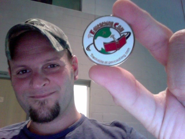
Well, it may not have traveled far (only 875 miles) and it may not have made it to many states in America yet (only 3), but the Educaching Team is still proud of our little guy! The first official Educaching Geocoin has been rounding our little midwest area over the past couple years ever since it was born.

Learn about its travels here.

Being passed from cache to cache by ever-vigilant geocachers, travel bugs and coins like ours can really rack up the miles while making it fun for cache finders all over. The gist is to move them as soon as you find them!

Here are the links to a couple more travel bugs of mine that have been a little more successful in their travels (although they are lost now):


Emily's Egyptian Bug
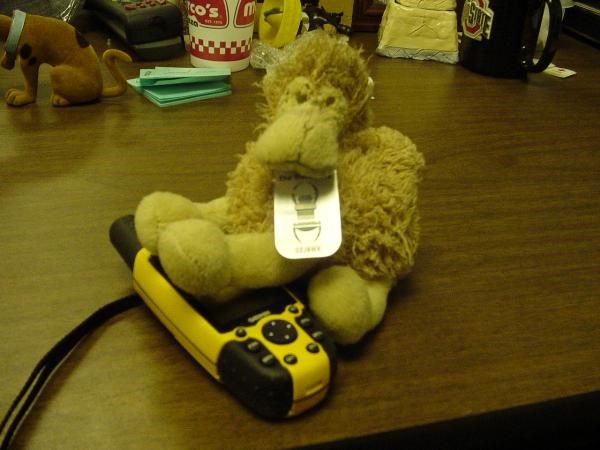
Goal: The mission of this travel bug is to take a tired, worn-out camel to Egypt where it belongs. A class in Ohio is watching its whereabouts, so please move along soon. Please take pictures of my journey along the way! P.S. I need to get to the great pyramids!
Current Status: Missing in action
Distance Traveled: 1,166 miles


Ben's Italian Bug
Mission: The goal of this bug is to travel as far east as possible this year from Ohio. Its end goal is to reside in Rome, Italy. Please send on quickly, as some 5th graders are eager to see its travels this school year. Take pictures, too!
Current Status: Also missing


Distance Traveled: 1,643 miles


In a previous post, I featured an activity page for you to use with your students to brainstorm ideas for a travel bug/geocoin's mission. Feel free to copy and use this as you wish (see below), and good luck in your endeavors to send out your own trackables! For more information on trackables, visit here.

Thursday, October 17, 2013

Geocaching and Education, part 12 - Absolute and Relative Location


T
his is post #12 in a series of free resources for educators interested in using geocaching in education and other community groups like scouts or camps. The material is pulled directly from Educaching GPS Based Curriculum for Teachers. If interested in more resources, check out www.educaching.com.

Sincerely,
Jason Hubbard, Author


Absolutely Relative or Relatively Absolute – This activity allows your students to understand the difference between absolute location and relative location. Absolute location is what we use to describe an exact location. For example, 27979 White Road, Perrysburg, OH 43551 is an absolute location. Absolute location can also be found using waypoints in a GPS receiver---it is an exact spot on the map. Relative location involves a slightly less precise way to locate something, but we use it all the time. When we are telling someone how to find a gas station we say, “It’s two blocks down, then turn right, go over the railroad tracks and you can’t miss it. It’s beside the post office.” Relative location is described in great detail through the use of distances, directions, amount of time taken, and landmarks along the way. This is an important activity, because your students will be employing skills in both when they are Educaching. For example, when on a hunt, they use absolute location (coordinates) to find an Educache’s spot, but will also receive clues using relative location (i.e. under the rock, beside the tree, about 300 feet from the front doors of the school, etc.). Let’s use Educaching to teach the concept to your students by setting up a hunt that requires them to use both. To make things simpler, this will be a group hunt similar to the activity on Day 1. You will hide two Educache containers. The first one will be a small container with a set of directions inside to get to the second Educache. The students will use coordinates and their GPS to get to the first Educache (absolute location) and descriptive directions to reach the second (relative location). Find a hiding spot for the first Educache, then from that spot, look to see where you will place the second. Be creative! How can you describe how to get there? For example, will the students count paces? Will they head in a specific direction, like Northeast? Will they look for any signs or landmarks on the way? Try combining several of these clues to get the group from the first Educache to the second. Test out your directions by walking the path to your second Educache spot. Write these directions down and place them in the first Educache container and hide it in the first spot. Be sure to mark the waypoint in your GPS receiver to give the students these coordinates. Then, hide the second Educache in its spot containing a rewarding message to congratulate the students.On the day of this hunt, explain to your students the difference between absolute and relative location and have them give examples. Explain that they will use both in Educaching. Group your students so that they can share the GPS receivers, and give them the coordinates of the first location to input in their receivers now. Take the students outside and seek the first Educache together. When it is found, choose a student to open the container and read the directions one step at a time as the group follows the directions. Note: You may have to explain what a “pace” is if you used the word in your directions. Usually a pace is the distance covered by one step, or approximately three feet. Work as a large team to follow the directions carefully to the second Educache. The students may find that they need only to use the GPS to find compass bearing. As long as they are moving, the compass pointer on the GPS receiver will tell them the direction they are heading. When the students reach the area of the second Educache, tell them to look around for any good hiding spots where it might be. When it is found choose a student to open it and read the message inside. Before finishing this activity, review how absolute and relative location was used in this hunt. Also, see if the students can use their GPS receivers to calculate the distance between the two hidden educaches. Measurement is a vital skill used in most of the math lessons, and this would be a great point to have a mini-lesson on the topic.As a variation, you may want to have each small group look for its own educaches. This will require more preparation on your part, but will lead toward student independence. In this case, bring the students inside the classroom immediately afterward to discuss their successes and challenges with finding their educaches.

Thursday, September 12, 2013

More Back to School Books!

Well, I found a few more! Here we go:


1.) GPS and Geocaching in Education by Burt Lo - This book from ISTE combines the excitement of searching for hidden treasures with the joy of learning. Click here for a sample excerpt from the book.

2.) Geocaching for Schools and Communities - With connections to physical fitness, history, and science, this book has much to offer the beginning or intermediate geocaching teacher.


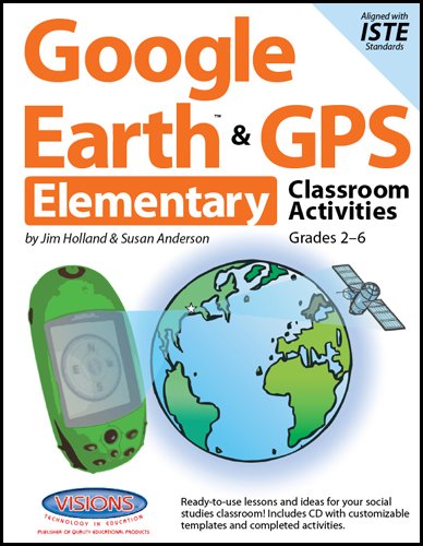
3.) Google Earth & GPS Elementary Classroom Activities - This is one of a series of spiral-bound books, packed with fantastic ideas. It is a great way to incorporate Google Earth as well for those rainy days when your outdoor hunt gets spoiled! Be sure to check out these others in the content areas:

Thursday, August 15, 2013

Back to School Books

So, you're thinking about adding a little Geocaching flair to your instruction this year? If you're looking for a good start on ideas, but need to know more about the concept, try some of these great guides:


1.) The Complete Idiot's Guide to Geocaching, 3rd Edition - This updated version of the guide is one of the most comprehensive resources out there for the sport. It is sure to give you a greater understanding of all things caching, as well as be a springboard for you for caching in education.


2.) Ben and The Geocache Treasure - I came across this book as a possible read-aloud for younger students. It introduces the fun and unique concept of caching to children, as well as provides important vocabulary and definitions.


3.) Found It! Introducing Geocaching To Kids and Families - Here's a Kindle book for a low-entry price that is sure to answer many of your questions.

Thursday, July 25, 2013

Freebies!

Here's a few free items to check out in case you missed them!

Geocaching and GPS In the Classroom - This pdf is from 2008, but offers some unique learning ideas to possibly meet the needs of your learners.

Dr. Christie's GPS and Geocaching Guide for Educators - This link is chock full of resources and lessons for the enthusiastic teacher!

Geocaching in the Classroom Virtual Conference - This hour long session provides good beginning insight into starting a GPS-based program at your school.

The Most Evil Geocache Ever! - I just had to post this video. If you've never looked for a "Difficulty 5" geocache, then you don't really know how frustrating it can be. DO NOT make your caches this hard for your students to find. :)


Thursday, May 16, 2013

Common Core Standards and Educaching

Thanks to the folks at Educaching, here's a list from their new website as to how their curriculum meets Common Core Math standards:

Educaching and Common Core Mathematics
Problem solving is at the root of Educaching! The curriculum incorporates mathematical reasoning, constructing, modeling, reasoning, and using tools strategically. Students must attend to precision in their mathematics, otherwise they cannot find what it is they’re looking for! And Educaching provides the student engagement and motivation necessary to navigate the waters of the common core. The Educaching curriculum can act as an incredible support beam for teachers. Here is an overview of the domains in grades 4-8 that Educaching specifically undergirds:

Grade 4:
Operations and Algebraic Thinking
  • Use the four operations with whole numbers to solve problems.
Number and Operations in Base Ten
  • Generalize place value understanding for multi-digit whole numbers.
  • Use place value understanding and properties of operations to perform multi-digit arithmetic.
Measurement and Data
  • Solve problems involving measurement and conversion of measurements from a larger unit to a smaller unit.
  • Represent and interpret data.
  • Geometric measurement: understand concepts of angle and measure angles.
Geometry
  • Draw and identify lines and angles, and classify shapes by properties of their lines and angles.
Mathematical Practices
1. Make sense of problems and persevere in solving them.
2. Reason abstractly and quantitatively.
3. Construct viable arguments and critique the reasoning of others.
4. Model with mathematics.
5. Use appropriate tools strategically.
6. Attend to precision.
7. Look for and make use of structure.
8. Look for and express regularity in repeated reasoning. Operations and Algebraic Thinking (4.OA)


Grade 5
Operations and Algebraic Thinking
  • Write and interpret numerical expressions.
  • Analyze patterns and relationships.
Number and Operations in Base Ten
  • Perform operations with multi-digit whole numbers and with decimals to hundredths.
Measurement and Data
  • Convert like measurement units within a given measurement system.
  • Represent and interpret data.
  • Geometric measurement: understand concepts of volume and relate volume to multiplication and to addition.
Geometry
  • Graph points on the coordinate plane to solve real-world and mathematical problems.
  • Classify two-dimensional figures into categories based on their properties.
Mathematical Practices
1. Make sense of problems and persevere in solving them.
2. Reason abstractly and quantitatively.
3. Construct viable arguments and critique the reasoning of others.
4. Model with mathematics.
5. Use appropriate tools strategically.
6. Attend to precision.
7. Look for and make use of structure.
8. Look for and express regularity in repeated reasoning.
Grade 6
The Number System
  • Multiply and divide multi-digit numbers and find common factors and multiples.
  • Apply and extend previous understandings of numbers to the system of rational numbers
Geometry
  • Solve real-world and mathematical problems involving area, surface area, and volume.
Statistics and Probability
  • Develop understanding of statistical variability.
  • Summarize and describe distributions.
Mathematical Practices
1. Make sense of problems and persevere in solving them.
2. Reason abstractly and quantitatively.
3. Construct viable arguments and critique the reasoning of others.
4. Model with mathematics.
5. Use appropriate tools strategically.
6. Attend to precision.
7. Look for and make use of structure.
8. Look for and express regularity in repeated reasoning.
Grade 7
Ratios and Proportional Relationships
  • Analyze proportional relationships and use them to solve real-world and mathematical problems.
Expressions and Equations
  • Solve real-life and mathematical problems using numerical and algebraic expressions and equations.
Geometry
  • Draw, construct and describe geometrical figures and describe the relationships between them.
  • Solve real-life and mathematical problems involving angle measure, area, surface area, and volume.
Mathematical Practices
1. Make sense of problems and persevere in solving them.
2. Reason abstractly and quantitatively.
3. Construct viable arguments and critique the reasoning of others.
4. Model with mathematics.
5. Use appropriate tools strategically.
6. Attend to precision.
7. Look for and make use of structure.
8. Look for and express regularity in repeated reasoning.


Grade 8
Geometry
  • Understand congruence and similarity using physical models, transparencies, or geometry software.
  • Understand and apply the Pythagorean Theorem.
  • Solve real-world and mathematical problems involving volume of cylinders, cones and spheres.
Mathematical Practices
1. Make sense of problems and persevere in solving them.
2. Reason abstractly and quantitatively.
3. Construct viable arguments and critique the reasoning of others.
4. Model with mathematics.
5. Use appropriate tools strategically.
6. Attend to precision.
7. Look for and make use of structure.
8. Look for and express regularity in repeated reasoning.
Thursday, April 18, 2013

Geocaching and Education, part 11 - A breath of fresh air...Two Quick and Fun Activities


This is post #11 in a series of free resources for educators interested in using geocaching in education and other community groups like scouts or camps. The material is pulled directly from Educaching GPS Based Curriculum for Teachers. If interested in more resources, check out www.educaching.com.

Sincerely,
Jason Hubbard, Author


Tennis Ball Madness - Give each of your student groups a tennis ball and a GPS receiver. Have the groups go out into the schoolyard to hide their tennis ball and mark a waypoint at the location of the ball. Give them a time limit and assist them with their receivers if needed. The students then return and give their GPS receiver to another group who uses it to go find the ball. A tennis ball, or plastic Easter egg if you prefer, provides an easier to find cache that will be a little easier to find. This activity gives students practice in mastering the GPS functions, especially in marking (saving) waypoints.

Grab It And Go – This one is very similar to the activity above, but is more of a relay. Give each team an object (i.e. golf ball, craft stick, action figure, etc.) and a GPS receiver. Each team hides their object, marks the waypoint in the receiver, then return. Teams trade receivers, then when you say “GO,” all teams find the other group’s hidden object, grab it, and race back to you as fast as possible. The team that makes it back first, wins! If you want to add another skill to this, give each group a map that they must mark down their object’s location on, along with the waypoint. Then, when they go find the other team’s object, they must also draw its location on their map, along with the waypoint before they bring the object back to you for the win. With younger students, this can be a great way to review cardinal directions and basic map skills. It is also a great way for ALL students to get some exercise!

Thursday, March 14, 2013

Geocaching and Education, part 10 - The Schoolyard Stash


This is post #10 in a series of free resources for educators interested in using geocaching in education and other community groups like scouts or camps. The material is pulled directly from Educaching GPS Based Curriculum for Teachers. If interested in more resources, check out www.educaching.com.

Sincerely,
Jason Hubbard, Author

*The following lesson is meant for a beginning teacher to dive into the waters of educaching with students.


The Schoolyard Stash 
         This activity is highly recommended as it will serve as a way to do more class instruction, while giving your students more independence. As preparation, you’ll need to hide about 7 containers. Try to make a few of the containers different sizes; some film canisters, some small Tupperware, some shoe box-sized. The reason you are doing this is so the students understand that not all Educache containers look alike, especially in size (i.e. You will not be hiding film canisters all the time!). Place within each container a simple math problem or a fun trivia question. Make it something that they can answer without too much difficulty. Hide each one carefully and mark the waypoints of each with your GPS receiver. You may also want to bring along a teacher map and mark the location and waypoint of each one for your reference. Write down each waypoint on a scrap of paper and put them in a hat for students to draw from on the day of your hunt.
          Okay, let’s go Educaching! Assemble groups and have each group choose one piece of paper out of the hat. Inform them that this is the waypoint for the educache they need to find today. This is a great time to introduce and assign the group roles of Navigator, Scribe, Reader, and Photographer (optional). Pass out the GPS receivers (and any instructions you may want) and have each group input their waypoint in their receiver, reviewing with them how to do this. Remind them to double check their coordinates!
          Now take the groups out to a central meeting spot in the schoolyard. Give them specific instructions that they are to use their compass pointers to find their educache, just as they did before. When they find it, they are to open it and solve the math problem or the trivia question inside. They then replace the question inside the container and bring the container back with them to the central meeting spot. Give your students a time limit you deem appropriate (10 minutes ought to be plenty of time). Assist any groups as needed with the equipment, but resist giving them the answers. Instead, ask questions like, “What do you think?” or “Which button would make the most sense to press now?” Encourage teamwork, but help them become independent from you and do not solve the mystery for them. Be sure each group finds their educache. Some students that finish early might be very willing to help another group that is experiencing trouble. This promotes a larger sense of teamwork in the class.
           When all groups are finished and back at the meeting spot, have each group show their educache to the other students. Have them open it, read the problem or question, then give their answer. Encourage teamwork among the class by having everyone clap for each group’s success. Even if they don’t get the answer to the question right, each group still was able to use the technology and with careful observation correctly locate their educache. Close this activity by reviewing terminology, features of the GPS receivers, or answer questions. You may even want to introduce the sport of geocaching and discuss the possibility of hiding an educache for others around the world to find, or to introduce the concept of CITOWhen finished with the activity, have the students bring all materials back inside the building. See the Beyond The Basics section of the Educaching curriculum for these ideas and much more! 

Thursday, January 31, 2013

Putting Waypoints on Multiple Receivers

For a large set of receivers, if you want to quickly put your waypoints on all of them, you have to have the right software. There are several free options, which, depending upon your tech-savviness, may take a bit of practice and finagling. Depending upon your type of receivers AND your type of computer, you may find the following useful:

For Garmin GPS receivers: Garmin BaseCamp - This software is free and is available for PC or Mac. Garmin BaseCamp will allow you to upload waypoints from one receiver to the program. Then, you can easily change the names of your waypoints, organize into hunt lists (i.e. Golf Ball Hunt, Madison Elementary Autumn Cache event, etc.), and hook up each individual receiver after that in order to download to all of your units.

For Magellan GPS receivers: VantagePoint - This software works much like Garmin's BaseCamp, except it is only available as a PC download. So if you have a Mac computer and you use Magellan units, I have used MacCaching free software and it works well.

For Geomate.jr receivers: Go here to sign up for a free account. Then download what you need for your PC or Mac here. From that point, you use the Custom Cache tab to upload waypoints from one Geomate device, then download to all your Geomates.

With any software, you are bound to run into glitches and tech issues! This is where Google searching for solutions can be very helpful. Be patient, do some research, ask around, check the software requirements. A simple driver may need to be downloaded and your computer restarted first before it will work. Be willing to contact the software designers or check forums on their websites to dig for more info. if you're still having trouble.

There are others out there...this post only scraped the surface. Feel free to post any others in the comments!

Keep 'em educaching,

Jason and the Educaching Team